
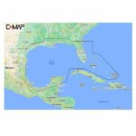
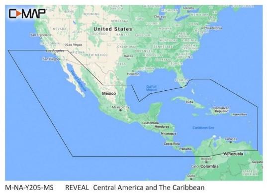

C-MAP Reveal – Central America and Caribbean

SKU: CMAPM-NA-Y205-MS

C-MAP Reveal – Central America and Caribbean

$260.00

Out of stock

Out of stock

We also install it: professional marine electronics installation in South Florida.

Shipping & sourcing
  • Ships from Pompano Beach, FL, United States.
  • Handling: 1 business day. Delivery: 1 to 7 business days within the United States.
  • Shipping is calculated at checkout by the carrier. Orders of $199 or more ship free.
  • Product images and specifications are supplied by the manufacturer.
Shipping & returns policy
0 People watching this product now!

Payment Methods:

C-MAP Reveal – Central America and Caribbean

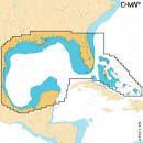
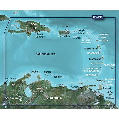
The C-MAP Reveal – Central America and Caribbean is a marine chart designed for Lowrance, Simrad, and B&G chartplotters, providing detailed underwater views of fish and structures. This product is essential for enhancing navigation and fishing strategies in these regions.

Compatibility & Applications

  • Fits Lowrance, Simrad, and B&G chartplotters for direct use.
  • Provides enhanced navigation capabilities for vessels operating in Central America and the Caribbean.
  • Replaces older marine charts, ensuring up-to-date information.
  • Wires to NMEA 2000 for real-time data sharing between devices.
  • Supports fishing and navigation strategies through detailed underwater views.
  • Mounts easily in chartplotter systems for quick reference while navigating.

The unit allows for precise navigation and fishing planning in the Central America and Caribbean regions, making it a crucial tool for mariners. Its compatibility with leading chartplotters ensures effective use in diverse marine environments, offering a significant upgrade over outdated charts.

Technical Specifications

Weight 0.07 lbs
Dimensions (L × W × H) 4.00 × 6.00 × 2.00 in
Weight0.5 lbs
Dimensions4 × 6 × 2 in
Weight0.07 lbs (0.03 kg)
Dimensions4 x 6 x 0 in (102 x 152 x 0 mm)
CompatibilityLowrance, Simrad, B&G chartplotters
TypeMarine chart
RegionCentral America and Caribbean
Included AccessoriesNone
MaterialPaper
CertificationISO 9001
Country of OriginUSA
MFG#M-NA-Y205-MS

Description

C-MAP Reveal – Central America and Caribbean

The C-MAP Reveal – Central America and Caribbean is a marine chart designed for Lowrance, Simrad, and B&G chartplotters, providing detailed underwater views of fish and structures. This product is essential for enhancing navigation and fishing strategies in these regions.

Compatibility & Applications

  • Fits Lowrance, Simrad, and B&G chartplotters for direct use.
  • Provides enhanced navigation capabilities for vessels operating in Central America and the Caribbean.
  • Replaces older marine charts, ensuring up-to-date information.
  • Wires to NMEA 2000 for real-time data sharing between devices.
  • Supports fishing and navigation strategies through detailed underwater views.
  • Mounts easily in chartplotter systems for quick reference while navigating.

The unit allows for precise navigation and fishing planning in the Central America and Caribbean regions, making it a crucial tool for mariners. Its compatibility with leading chartplotters ensures effective use in diverse marine environments, offering a significant upgrade over outdated charts.

Technical Specifications

Weight 0.07 lbs
Dimensions (L × W × H) 4.00 × 6.00 × 2.00 in

Specification

Overview

Weight0.5 lbs
Dimensions4 × 6 × 2 in
Weight0.07 lbs (0.03 kg)
Dimensions4 x 6 x 0 in (102 x 152 x 0 mm)
CompatibilityLowrance, Simrad, B&G chartplotters
TypeMarine chart
RegionCentral America and Caribbean
Included AccessoriesNone
MaterialPaper
CertificationISO 9001
Country of OriginUSA
MFG#M-NA-Y205-MS

Customer Reviews