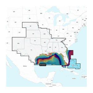


C-MAP Reveal X – GULF OF MEXICO AND BAHAMAS
The C-MAP Reveal X – GULF OF MEXICO AND BAHAMAS is a marine navigation chart designed specifically for the Gulf of Mexico and the Bahamas, delivering detailed mapping data critical for safe navigation. It is installed by marine electronics professionals in compatible chartplotters.
Compatibility & Applications
- Fits specific marine chartplotters for enhanced navigation.
- Provides detailed nautical data for the Gulf of Mexico region.
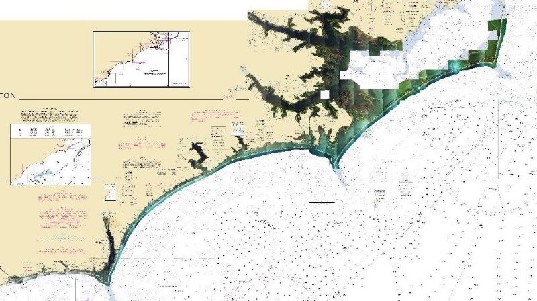
- Includes bathymetric data for precise depth contour mapping.
- Replaces older C-MAP versions for improved navigation accuracy.
- Wires to NMEA 2000 systems for data integration.
- Mounts in both recreational and commercial vessels up to 50 ft.
The unit enhances navigation accuracy in the Gulf of Mexico and Bahamas by providing updated cartographic information essential for safe maritime operations. It serves as a direct replacement for older C-MAP chart versions, ensuring users have access to the latest navigational data. For example, it can be installed in a 30-foot center console boat, providing real-time updates and detailed mapping for fishing expeditions.