


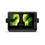


GARMIN ECHOMAP UHD2 94sv Chartplotter
The GARMIN ECHOMAP UHD2 94sv is a 9-inch chartplotter that includes Garmin Navionics+ U.S. Coastal and Great Lakes mapping for precise navigation. This unit is designed for marine navigation, providing detailed charts and user-friendly controls for installation on vessels ranging from 20 to 40 feet in length.
Compatibility & Applications
- Fits standard mounting brackets for easy installation on boats.
- Pairs with various Garmin transducers for enhanced sonar capabilities.
- Integrates with NMEA 2000 for connectivity with other marine electronics.
- Mounts on center consoles, flybridges, and helm stations of vessels 20-40 ft.
- Replaces older GARMIN chartplotters such as the GPSMAP 7400 series.
- Wires to 12V DC power systems for direct installation.
The unit provides advanced navigation features and high-resolution mapping, making it an upgrade for vessels navigating coastal and inland waterways. An installation scenario includes mounting on a center console of a 30-foot sportfish boat, providing enhanced chart detail compared to older chartplotters.