
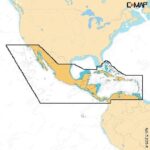

C-MAP Reveal X – U.S. Lakes South East

Part Number: M-NA-T-214-R-MS · Category: Marine Charts & Maps

C-MAP

$199.00

In stock · ships from Pompano Beach, FL

6 in stock

Request a QuoteSeveral units or a fleet job? Ask for volume pricing.
Item
Shipping
Total
Oversize item: call (786) 277-2596 for a freight quote.
Ships from Pompano Beach, FL. Rate shown is for Florida (1-2 business days); other states 1 to 7 business days, exact rate by ZIP at checkout.
★★★★★ 5.0 rated on Google (21 reviews) · ✓ 30-day returns · ✓ Secure payment by Stripe

We sell it. We install it.

Professional marine electronics installation available in South Florida. Free quotes, and boat pickup and transport for qualifying boats and projects.

Get an Installation Quote Call +1 (786) 277-2596

Shipping & sourcing
  • Ships from Pompano Beach, FL, United States.
  • Handling: 1 business day. Delivery: 1 to 7 business days within the United States.
  • Shipping is calculated at checkout by the carrier. Orders of $199 or more ship free.
  • Product images and specifications are supplied by the manufacturer.
Shipping & returns policy
0 People watching this product now!

Payment Methods:

Product details

BrandC-MAP
Part NumberM-NA-T-214-R-MS
CategoryMarine Charts & Maps
AvailabilityIn stock
Ships fromPompano Beach, FL · 1 business day handling
InstallationAvailable in Pompano Beach and Broward County
Weight0.5 lbs

C-MAP Reveal X – U.S. Lakes South East

The C-MAP Reveal X – U.S. Lakes South East is a digital chart solution designed for marine navigation, providing detailed mapping of southeastern U.S. lakes. This product is intended for installation in compatible chartplotters and multifunction displays.

Compatibility & Applications

  • Fits into compatible C-MAP and Simrad multifunction displays.
  • Integrates with NMEA 2000 for enhanced navigation data.
  • Provides detailed coverage for lakes in the southeastern U.S.
  • Updates existing C-MAP chart systems with enhanced detail.
  • Pairs with recreational boating and fishing applications for improved route planning.
  • Mounts easily into existing chartplotter slots without additional hardware.
  • Replaces older C-MAP charts for seamless upgrades.
  • Supports installation on vessels ranging from 20 to 40 feet.

The unit enhances navigation by providing detailed topographical mapping of lakes, ensuring accurate and reliable navigation for boaters. It serves as a drop-in replacement for older C-MAP models, offering advanced features like shaded relief for improved visibility during navigation.

Technical Specifications

Weight 0.07 lbs
Dimensions (L × W × H) 4.00 × 6.00 × 2.00 in
Weight0.5 lbs
Dimensions24 × 36 × 1 in
Weight0.07 lbs (0.03 kg)
Dimensions4 x 6 x 0 in (102 x 152 x 0 mm)
Chart TypeDigital vector chart
CompatibilityCompatible with selected C-MAP and Simrad devices
FeaturesShaded relief, dynamic mapping
Country of OriginUSA
Warranty1 year limited warranty
Connector TypeSD card format
Operating Temperature Range-4°F to 158°F (-20°C to 70°C)
IP RatingIP67 (waterproof)
MFG#M-NA-T-214-R-MS
UPC9420064129195
0 reviews
0
0
0
0
0

There are no reviews yet.

Be the first to review “C-MAP Reveal X – U.S. Lakes South East”

Your email address will not be published. Required fields are marked *

1 2 3 4 5
1 2 3 4 5
1 2 3 4 5

Description

C-MAP Reveal X – U.S. Lakes South East

The C-MAP Reveal X – U.S. Lakes South East is a digital chart solution designed for marine navigation, providing detailed mapping of southeastern U.S. lakes. This product is intended for installation in compatible chartplotters and multifunction displays.

Compatibility & Applications

  • Fits into compatible C-MAP and Simrad multifunction displays.
  • Integrates with NMEA 2000 for enhanced navigation data.
  • Provides detailed coverage for lakes in the southeastern U.S.
  • Updates existing C-MAP chart systems with enhanced detail.
  • Pairs with recreational boating and fishing applications for improved route planning.
  • Mounts easily into existing chartplotter slots without additional hardware.
  • Replaces older C-MAP charts for seamless upgrades.
  • Supports installation on vessels ranging from 20 to 40 feet.

The unit enhances navigation by providing detailed topographical mapping of lakes, ensuring accurate and reliable navigation for boaters. It serves as a drop-in replacement for older C-MAP models, offering advanced features like shaded relief for improved visibility during navigation.

Technical Specifications

Weight 0.07 lbs
Dimensions (L × W × H) 4.00 × 6.00 × 2.00 in

Specification

Overview

Weight0.5 lbs
Dimensions24 × 36 × 1 in
Weight0.07 lbs (0.03 kg)
Dimensions4 x 6 x 0 in (102 x 152 x 0 mm)
Chart TypeDigital vector chart
CompatibilityCompatible with selected C-MAP and Simrad devices
FeaturesShaded relief, dynamic mapping
Country of OriginUSA
Warranty1 year limited warranty
Connector TypeSD card format
Operating Temperature Range-4°F to 158°F (-20°C to 70°C)
IP RatingIP67 (waterproof)
MFG#M-NA-T-214-R-MS
UPC9420064129195

Customer Reviews

0 reviews
0
0
0
0
0

There are no reviews yet.

Be the first to review “C-MAP Reveal X – U.S. Lakes South East”

Your email address will not be published. Required fields are marked *

1 2 3 4 5
1 2 3 4 5
1 2 3 4 5