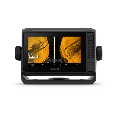
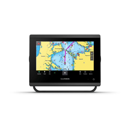
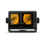
ECHOMAP™ UHD2 7″ sv Chartplotters
$899.99
ECHOMAP™ UHD2 7″ Chartplotter helps you catch more fish with crystal-clear ClearVu & SideVu Sonar, 9-inch touchscreen display, & Garmin Navionics+ preloaded maps.
Did you like this product? Add to favorites now and follow the product.
We are experts and sell products with a 15% discount with installation. Contact us via any method you prefer, such as WhatsApp, email, or SMS, or ask the team to sell you the equipment. Start Live Chat
- Description
- Additional information
- Reviews (0)
- Specifications
- In the Box
- More Offers
- Store Policies
- Inquiries
Description
KNOW THE WATER BETTER THAN A LOCAL
When it comes to catching more fish, they say, “Talk to a local.” With the ECHOMAP UHD2 chartplotter, which offers our best-in-class sonar and mapping and premium touchscreen display with keyed-assist, you’ll know the water even better than they do.
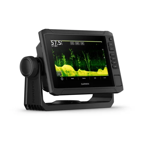
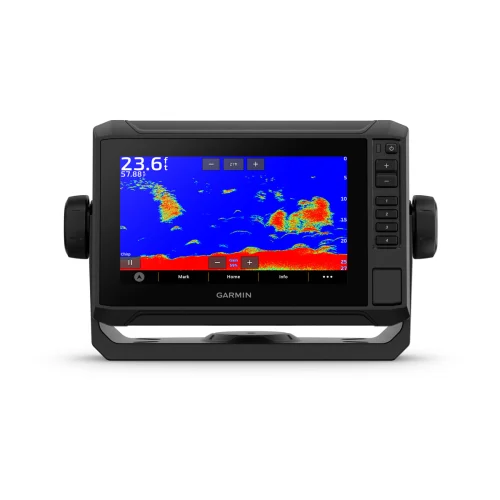
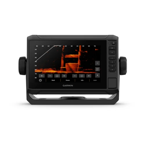
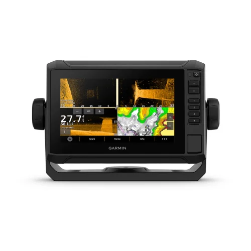
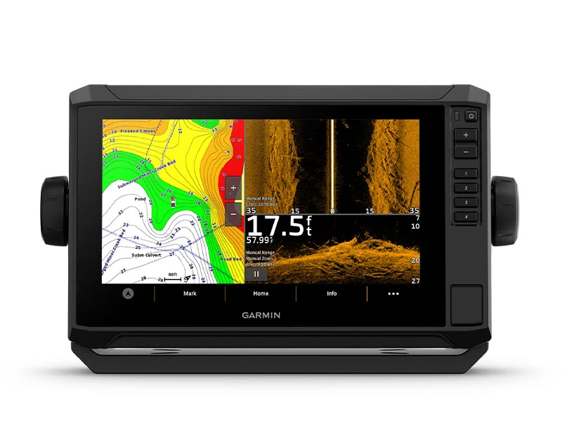
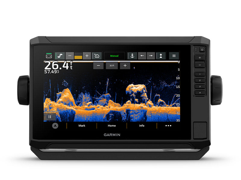
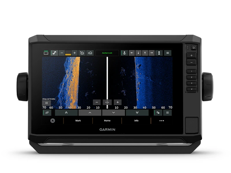
SONAR SUPPORT
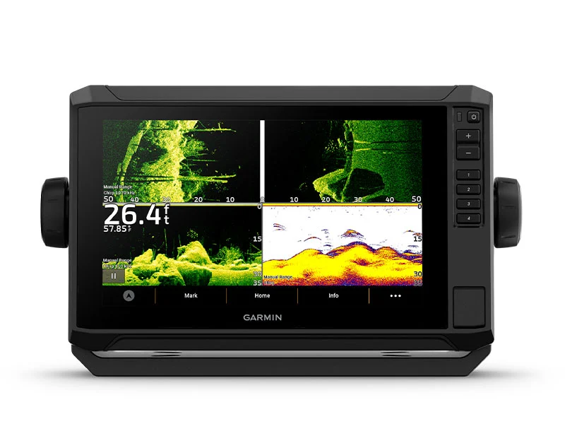
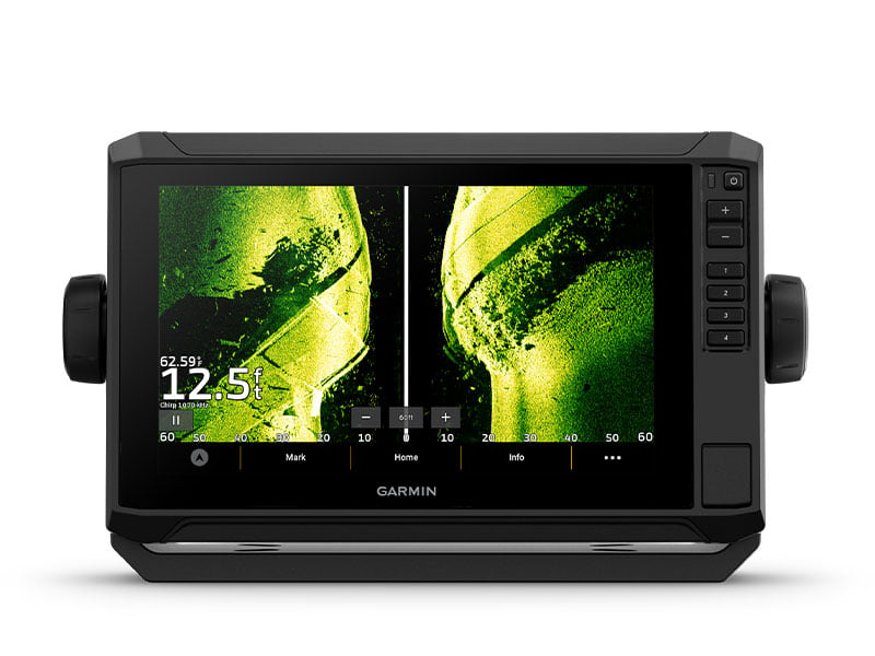
With crisp, clear traditional sonar and brilliant ClearVü and SideVü scanning sonars, the fish will have nowhere to hide. Your ECHOMAP UHD2 also supports LiveScope™ live-scanning sonar.
VIVID COLOR PALETTES
High-contrast vivid scanning sonar color palettes make it easier than ever to distinguish targets and structure.
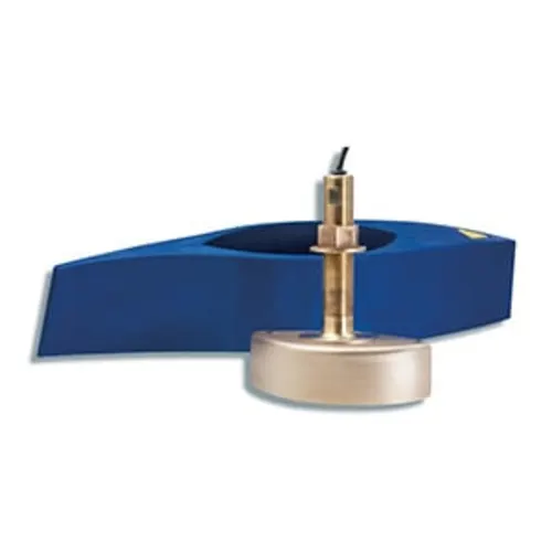
BUNDLE YOUR TRANSDUCER
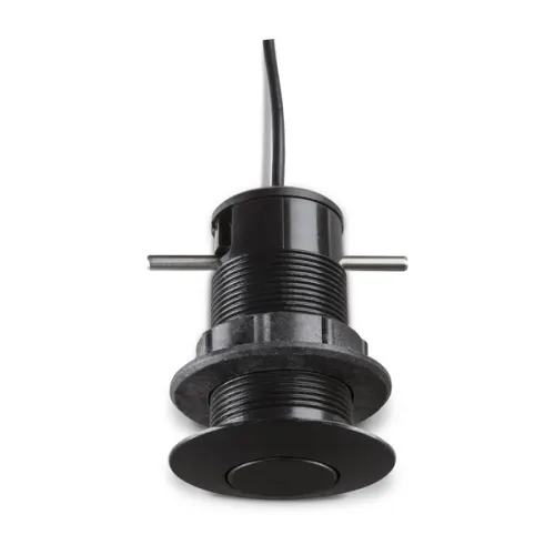
Your ECHOMAP UHD2 device supports a variety of Garmin transducers. The 6” and 7” chartplotters come bundled with a GT54 transducer — while the 9” chartplotter comes with a GT56 transducer.
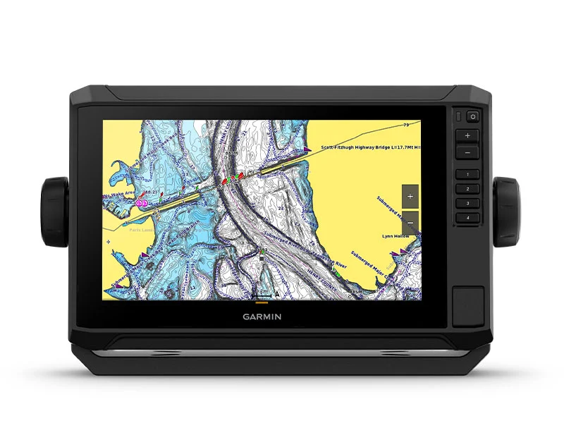
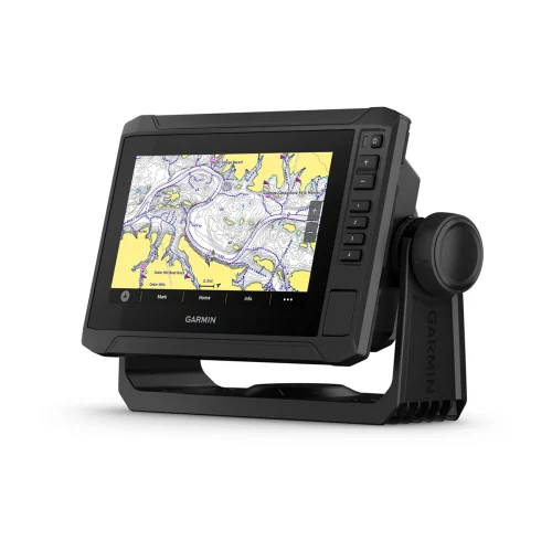
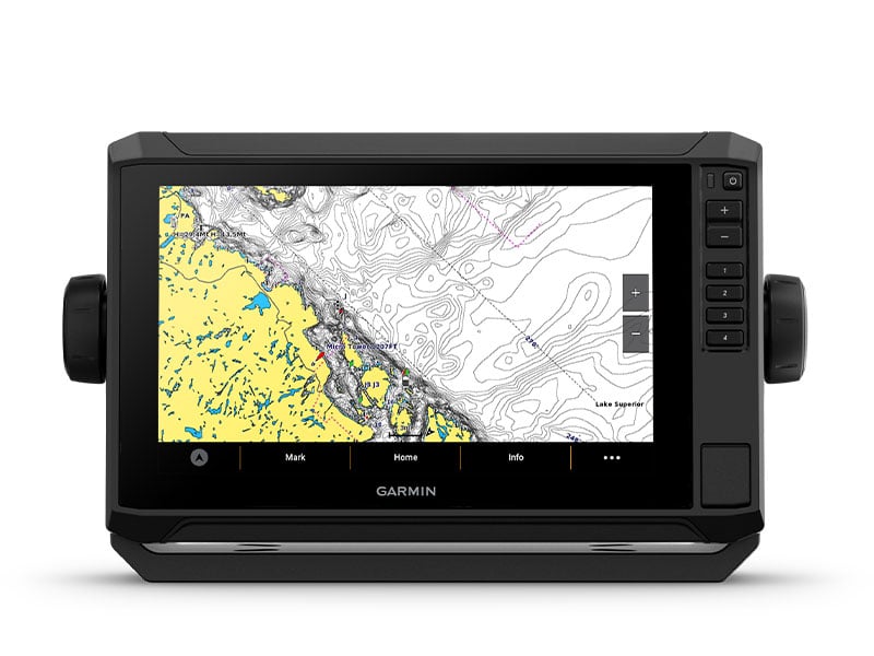
PRELOADED CHARTS
You’ve never seen Garmin cartography like this before. Select chartplotters come with built-in Garmin Navionics+ cartography which includes a 1-year subscription for daily updates, depth range shading and more.
WIRELESS NETWORKING
If you have another compatible ECHOMAP UHD2 chartplotter on your boat, you can wirelessly share information — such as sonar1, waypoints and routes — with them.
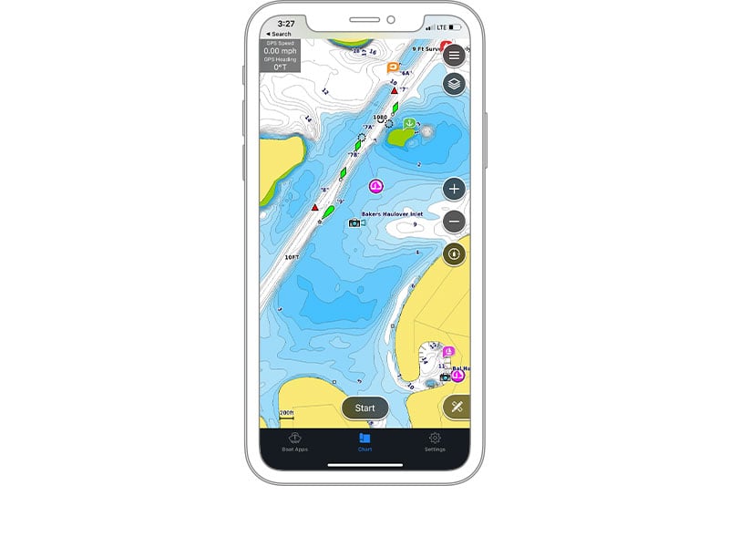
ACTIVECAPTAIN® APP
Built-in Wi-Fi® connectivity pairs with the free all-in-one mobile app on your compatible smartphone for access to the OneChart™ feature, smart notifications, software updates, Garmin Quickdraw™ Community data and more2.
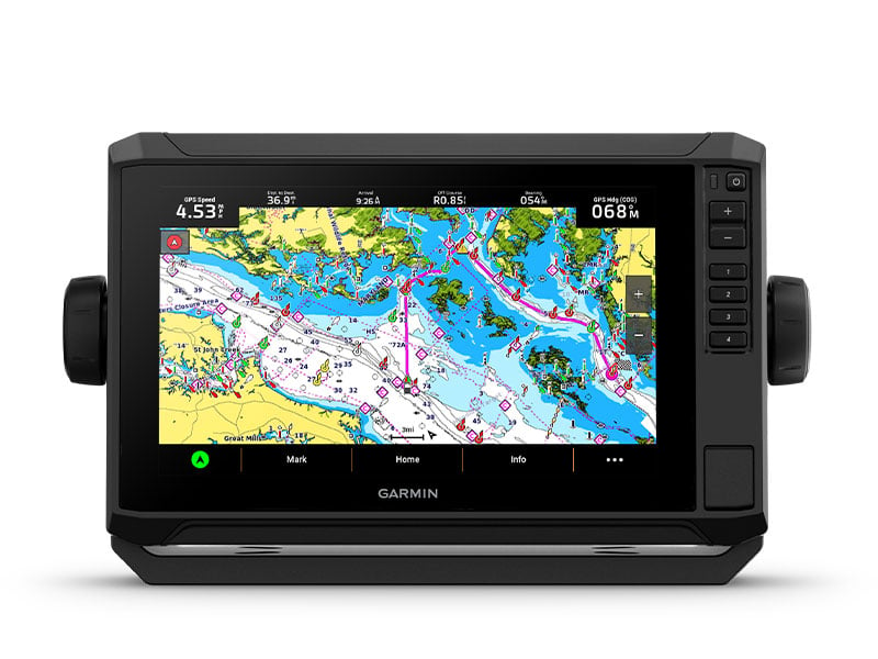
AUTO GUIDANCE+™ TECHNOLOGY
Chartplotters with built-in Garmin Navionics+ charts include downloadable Auto Guidance+ technology3 with the ActiveCaptain app.
TROLL WITH FORCE®
Your ECHOMAP UHD2 wirelessly connects to your Force trolling motor to create and follow routes, navigate to waypoints, control speed, check battery life and more.
POWER-POLE® SHALLOW WATER ANCHOR
By networking select Garmin chartplotters with a Force® trolling motor and your compatible Power-Pole shallow water anchoring system, you can access advanced boat control features4 from your plotter, including smart anchor auto-deployment, smart anchor jog, auto stow, anchor drag detection and auto guidance5 end-of-route anchoring. Spend more time fishing, less time positioning.
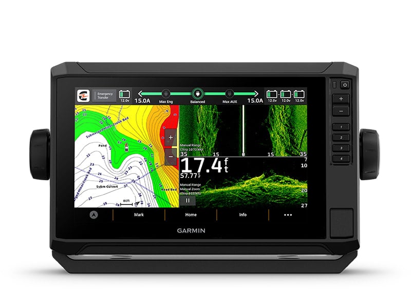
CHARGE INTEGRATION FROM POWER-POLE
Your CHARGE Marine Power Manager from Power-Pole integrates with compatible Garmin chartplotters to help keep your battery power going longer and stronger on the water. You’re able to charge batteries on the run, monitor power use, select where power is allocated, control emergency starts and even transfer power between battery banks — all from your chartplotter display.
MULTI-BAND GPS
Get improved position accuracy, particularly in areas where signals are reflected or weak, with multi-band GPS.
Additional information
| Dimension | 8.6" x 5.6" x 3.2" (21.8 x 14.2 x 8.1 cm) |
|---|---|
| Weight | 2.2 lbs (1.0 kg) |
| Water rating | IPX7 |
| Display Type | WVGA, TN |
| Display Size | 6.1" x 3.4", 7.0" (15.5 x 8.7 cm, 17.8 cm) |
| Display resolution | 800 x 480 pixels |
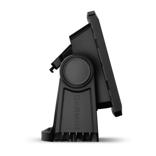
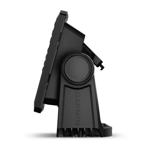
| Mounting Options | Bail or flush |
| Input | Touchscreen with keyed assist |
| Accepts Data Cards | 1 microSD™ card; 32 GB maximum size |
| Waypoints | 5,000 |
| Track points | 50,000 |
| Tracks | 50 saved tracks |
| Navigation Routes | 100 |
| Receiver | 10 Hz |
| Built-in Auto Guidance+ | yes (downloadable via ActiveCaptain app) |
| Garmin Navionics+ Inland & Coastal | yes (see Additional) |
| Garmin Navionics+ (Coastal) | yes (see Additional) |
| Garmin Navionics+ (Inland) | yes (see Additional) |
| Tide tables | yes (see Additional) |
| Power Input | 9 to 18 Vdc |
| Typical current draw at 12 Vdc | 1.52 A |
| Maximum current draw at 12 Vdc | 3.2 A |
| Maximum power usage at 10 Vdc | 18.3W |
| Power output | 500 W |
| Traditional sonar (dual frequency/beam) | Built-in (single channel CHIRP, 50/77/83/200 kHz, L, M, H CHIRP) |
| ClearVü | Built-in 260/455/800/1000/1200 kHz |
| SideVü | Built-in 260/455/800/1000/1200 kHz |
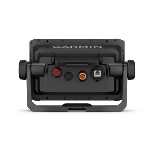
| Garmin Marine Network Ports | 1 |
| 12-pin transducer ports | 1 |
| Additional | Garmin Navionics+ (inland and coastal): 75sv Canada, Australia and New ZealandGarmin Navionics+ (coastal): 74sv U.S. coastal, 75sv UK/IrelandGarmin Navionics+ (inland): 73sv U.S. lakesTide tables: 73sv, 74sv, 75sv |
| Brand | Garmin |
General
| Dimension | 8.6" x 5.6" x 3.2" (21.8 x 14.2 x 8.1 cm) |
|---|---|
| Weight | 2.2 lbs (1.0 kg) |
| Water rating | IPX7 |
| Display Type | WVGA, TN |
| Display Size | 6.1" x 3.4", 7.0" (15.5 x 8.7 cm, 17.8 cm) |
| Display resolution | 800 x 480 pixels |
| Mounting Options | Bail or flush |
| Input | Touchscreen with keyed assist |
| Accepts Data Cards | 1 microSD™ card; 32 GB maximum size |
| Waypoints | 5,000 |
| Track points | 50,000 |
| Tracks | 50 saved tracks |
| Navigation Routes | 100 |
| Receiver | 10 Hz |
| Built-in Auto Guidance+ | yes (downloadable via ActiveCaptain app) |
| Garmin Navionics+ Inland & Coastal | yes (see Additional) |
| Garmin Navionics+ (Coastal) | yes (see Additional) |
| Garmin Navionics+ (Inland) | yes (see Additional) |
| Tide tables | yes (see Additional) |
| Power Input | 9 to 18 Vdc |
| Typical current draw at 12 Vdc | 1.52 A |
| Maximum current draw at 12 Vdc | 3.2 A |
| Maximum power usage at 10 Vdc | 18.3W |
| Power output | 500 W |
| Traditional sonar (dual frequency/beam) | Built-in (single channel CHIRP, 50/77/83/200 kHz, L, M, H CHIRP) |
| ClearVü | Built-in 260/455/800/1000/1200 kHz |
| SideVü | Built-in 260/455/800/1000/1200 kHz |
| Garmin Marine Network Ports | 1 |
| 12-pin transducer ports | 1 |
| Additional | Garmin Navionics+ (inland and coastal): 75sv Canada, Australia and New ZealandGarmin Navionics+ (coastal): 74sv U.S. coastal, 75sv UK/IrelandGarmin Navionics+ (inland): 73sv U.S. lakesTide tables: 73sv, 74sv, 75sv |
- ECHOMAP UHD2 (device varies depending on selection)
- GT54-TM transducer
- Power cable
- Tilt/swivel mount with quick release cradle
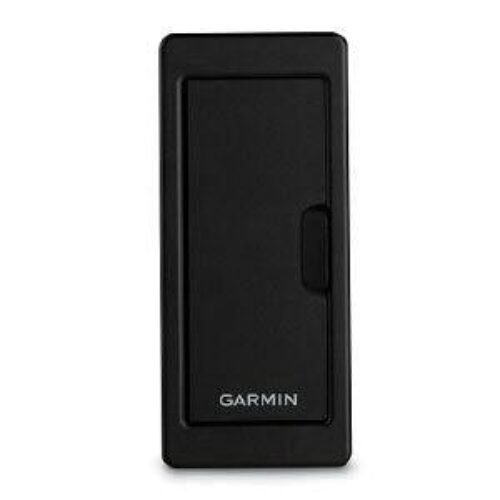
- Protective cover
- Hardware
- Documentation
- ECHOMAP UHD2 (device will vary depending on selection)
- 12-pin sounder to 8-pin transducer cable
- Power cable
- Tilt/swivel mount with quick release cradle
- Protective cover
- Hardware
- Documentation
General Inquiries
There are no inquiries yet.
Related products
Recently Viewed Products
ECHOMAP™ UHD2 7″ sv Chartplotters
$899.99Copyright 2026 © marineoverhauling

Reviews
There are no reviews yet.