


GARMIN Navionics+ U.S. East, Navionics Platinum+ microSD/SD Card NPUS007R
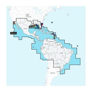
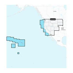
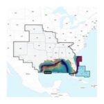
The GARMIN Navionics+ U.S. East, Navionics Platinum+ microSD/SD card NPUS007R is a navigation solution designed for marine environments, providing detailed cartography for the U.S. East Coast. This card enhances charting capabilities for compatible GARMIN devices, allowing for improved navigation and planning.
Compatibility & Applications
- Fits GARMIN chartplotters with microSD/SD card slots.
- Enhances navigation for vessels 18–30 ft and larger.
- Pairs with GARMIN GPS systems for advanced charting features.
- Replaces older Navionics cards for updated navigation data.
- Wires to NMEA 2000 networks for integrated navigation solutions.
The unit provides comprehensive mapping and navigation tools, making it a suitable upgrade for existing GARMIN devices. Its detailed coastal charts ensure reliable navigation for recreational and commercial users alike.