

GARMIN Navionics+ U.S. West – Inland and Coastal Marine Charts

SKU: GAR010-C1292-20

GARMIN Navionics+ U.S. West – Inland and Coastal Marine Charts

$149.99

1 in stock

1 in stock

We sell it. We install it.

Professional marine electronics installation available in South Florida. Free quotes, and boat pickup and transport for qualifying boats and projects.

Get an Installation Quote Call +1 (786) 277-2596

Shipping & sourcing
  • Ships from Pompano Beach, FL, United States.
  • Handling: 1 business day. Delivery: 1 to 7 business days within the United States.
  • Shipping is calculated at checkout by the carrier. Orders of $199 or more ship free.
  • Product images and specifications are supplied by the manufacturer.
Shipping & returns policy
0 People watching this product now!

Payment Methods:

GARMIN Navionics+ U.S. West – Inland and Coastal Marine Charts

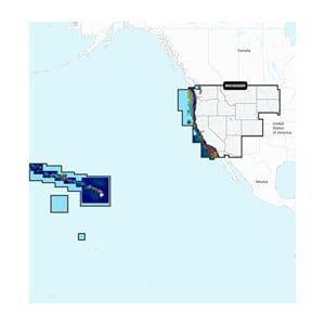
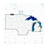
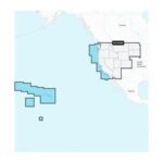
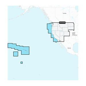
The GARMIN Navionics+ U.S. West is a detailed marine charting solution for inland and coastal navigation, covering the U.S. West Coast and inland waters. It is designed for installation in compatible GARMIN chartplotters, providing essential mapping for boaters.

Compatibility & Applications

  • Fits GARMIN chartplotters that accept microSD/SD cards.
  • Provides detailed mapping for coastal and inland waterways.
  • Updates existing GARMIN maps with additional features and data.
  • Integrates with GARMIN’s navigation systems for enhanced route planning.
  • Replaces older GARMIN Navionics chart versions for improved accuracy.
  • Mounts in various GARMIN devices including GPSMAP and echoMAP series.

The unit enhances navigation capabilities by offering detailed marine charts for the U.S. West Coast and inland waterways. It serves as a drop-in replacement for older charts, ensuring updated data and features for reliable route planning and navigation accuracy.

Technical Specifications

Weight 1.00 lbs
Dimensions (L × W × H) 2.10 × 3.20 × 0.10 in
Weight1 lbs
Dimensions2.1 × 3.2 × 0.1 in
Weight1 lb (0.45 kg)
Coverage AreaU.S. West Coast, Inland Waters
Chart TypeRaster and Vector Charts
UpdatesAnnual Updates Available
CompatibilityGARMIN Chartplotters
FormatMicroSD/SD Card
Dimensions2.1 x 3.2 x 0.1 in (53.3 x 81.3 x 2.5 mm)
Country of OriginUSA
Warranty1 year limited warranty
MFG#NSUS008R / 010-C1292-20
UPC753759289867

Description

GARMIN Navionics+ U.S. West – Inland and Coastal Marine Charts

The GARMIN Navionics+ U.S. West is a detailed marine charting solution for inland and coastal navigation, covering the U.S. West Coast and inland waters. It is designed for installation in compatible GARMIN chartplotters, providing essential mapping for boaters.

Compatibility & Applications

  • Fits GARMIN chartplotters that accept microSD/SD cards.
  • Provides detailed mapping for coastal and inland waterways.
  • Updates existing GARMIN maps with additional features and data.
  • Integrates with GARMIN’s navigation systems for enhanced route planning.
  • Replaces older GARMIN Navionics chart versions for improved accuracy.
  • Mounts in various GARMIN devices including GPSMAP and echoMAP series.

The unit enhances navigation capabilities by offering detailed marine charts for the U.S. West Coast and inland waterways. It serves as a drop-in replacement for older charts, ensuring updated data and features for reliable route planning and navigation accuracy.

Technical Specifications

Weight 1.00 lbs
Dimensions (L × W × H) 2.10 × 3.20 × 0.10 in

Specification

Overview

Weight1 lbs
Dimensions2.1 × 3.2 × 0.1 in
Weight1 lb (0.45 kg)
Coverage AreaU.S. West Coast, Inland Waters
Chart TypeRaster and Vector Charts
UpdatesAnnual Updates Available
CompatibilityGARMIN Chartplotters
FormatMicroSD/SD Card
Dimensions2.1 x 3.2 x 0.1 in (53.3 x 81.3 x 2.5 mm)
Country of OriginUSA
Warranty1 year limited warranty
MFG#NSUS008R / 010-C1292-20
UPC753759289867

Customer Reviews