
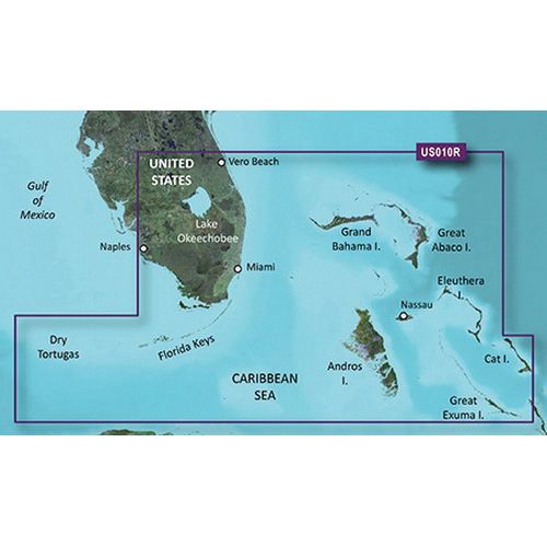


GARMIN VUS010R BlueChart G3 Vision MicroSD/SD Card Premier Coastal Nav. Chart, South Florida and North Bahamas

SKU: GARVISION/VUS010R/G3

GARMIN VUS010R BlueChart G3 Vision MicroSD/SD Card Premier Coastal Nav. Chart, South Florida and North Bahamas | 010-C0711-00

$349.99

1 in stock

1 in stock

16 People watching this product now!

Payment Methods:

GARMIN VUS010R BlueChart G3 Vision MicroSD/SD Card

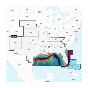
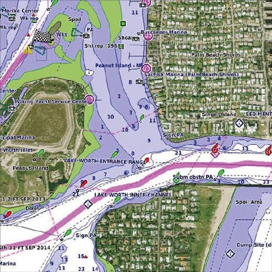
The GARMIN VUS010R BlueChart G3 Vision MicroSD/SD Card is a premier coastal navigation chart specifically for South Florida and the North Bahamas, weighing 1 lb (0.45 kg). This unit provides detailed marine charts and is designed for installation in compatible GARMIN chartplotters, enhancing navigation capabilities.

Compatibility & Applications

  • Wires to GARMIN chartplotters for enhanced navigation capabilities.
  • Integrates with existing GARMIN marine electronics for streamlined operation.
  • Provides detailed mapping for vessels operating in South Florida and North Bahamas.
  • Replaces older GARMIN chart cards for updated navigation data.
  • Supports yachts, fishing boats, and other vessels up to 40 ft.
  • Mounts into compatible GARMIN devices for immediate access to navigation charts.

The unit enhances navigation accuracy with updated coastal charts and integrates easily with GARMIN systems. Installation in a GARMIN chartplotter allows for immediate access to critical navigation information, differentiating it from generic chart cards that lack specific regional data.

Technical Specifications

Weight 1.00 lbs
Dimensions (L × W × H) 2.10 × 1.50 × 0.10 in
Weight1 lbs
Dimensions2.1 × 1.5 × 0.1 in
Weight1 lb (0.45 kg)
Chart RegionSouth Florida and North Bahamas
FormatMicroSD/SD Card
CompatibilityGARMIN chartplotters
Data CoverageDetailed coastal navigation charts
Update FrequencyAnnual updates available
Dimensions2.1 x 1.5 x 0.1 in (53.3 x 38.1 x 2.5 mm)
Country of OriginUSA
Warranty1 Year Limited Warranty

Description

GARMIN VUS010R BlueChart G3 Vision MicroSD/SD Card

The GARMIN VUS010R BlueChart G3 Vision MicroSD/SD Card is a premier coastal navigation chart specifically for South Florida and the North Bahamas, weighing 1 lb (0.45 kg). This unit provides detailed marine charts and is designed for installation in compatible GARMIN chartplotters, enhancing navigation capabilities.

Compatibility & Applications

  • Wires to GARMIN chartplotters for enhanced navigation capabilities.
  • Integrates with existing GARMIN marine electronics for streamlined operation.
  • Provides detailed mapping for vessels operating in South Florida and North Bahamas.
  • Replaces older GARMIN chart cards for updated navigation data.
  • Supports yachts, fishing boats, and other vessels up to 40 ft.
  • Mounts into compatible GARMIN devices for immediate access to navigation charts.

The unit enhances navigation accuracy with updated coastal charts and integrates easily with GARMIN systems. Installation in a GARMIN chartplotter allows for immediate access to critical navigation information, differentiating it from generic chart cards that lack specific regional data.

Technical Specifications

Weight 1.00 lbs
Dimensions (L × W × H) 2.10 × 1.50 × 0.10 in

Specification

Overview

Weight1 lbs
Dimensions2.1 × 1.5 × 0.1 in
Weight1 lb (0.45 kg)
Chart RegionSouth Florida and North Bahamas
FormatMicroSD/SD Card
CompatibilityGARMIN chartplotters
Data CoverageDetailed coastal navigation charts
Update FrequencyAnnual updates available
Dimensions2.1 x 1.5 x 0.1 in (53.3 x 38.1 x 2.5 mm)
Country of OriginUSA
Warranty1 Year Limited Warranty

Customer Reviews