
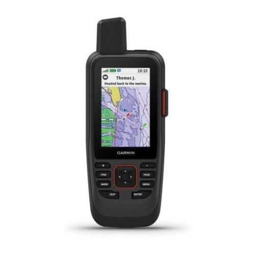
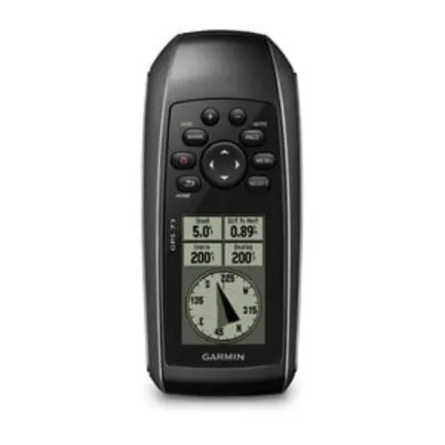
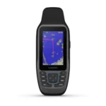
GPSMAP® 79 Series
$369.99
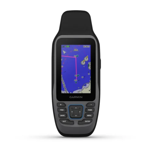
GPSMAP 79 is a marine handheld GPS is a rugged floating handheld with pre-loaded maps.
Did you like this product? Add to favorites now and follow the product.
We are experts and sell products with a 15% discount with installation. Contact us via any method you prefer, such as WhatsApp, email, or SMS, or ask the team to sell you the equipment. Start Live Chat
- Description
- Additional information
- Reviews (0)
- Specifications
- In the Box
- More Offers
- Store Policies
- Inquiries
Description
CAST OFF CONFIDENTLY
Stay on course, and track more adventures with these rugged, floating handhelds.
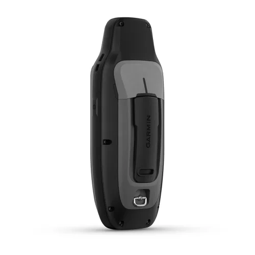
RUGGED HANDHELD
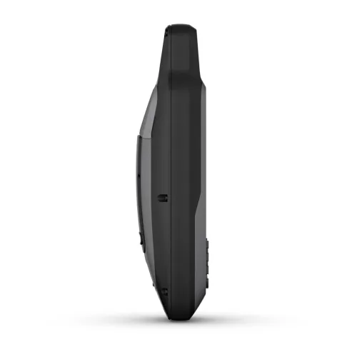
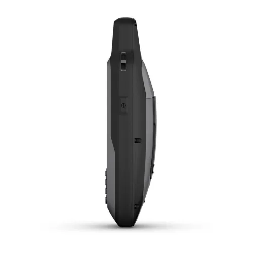
This handheld is water-resistant (IPX7) with a high-resolution color display you can read in the sun. The glass is even scratch-resistant and fogproof.
DESIGNED TO FLOAT
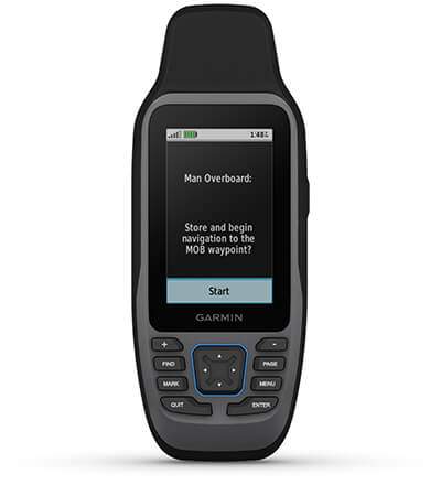
If rough waters come and the handheld goes overboard, don’t worry. This device floats.

BATTERY LIFE
User-replaceable AA batteries (not included) provide up to 19 hours of battery life in GPS tracking mode.
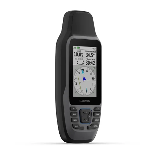
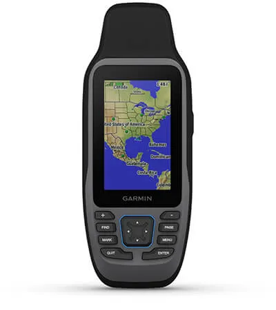
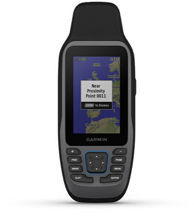
ACCURATE TRACKING
With support for multiple satellite constellations — such as GPS, GLONASS, Galileo, QZSS and SBAS — you’ll get accurate, reliable tracking and positioning around the world.
INCREASED MEMORY
More memory than previous models means you can save and track 10,000 waypoints, 250 routes and 300 fitness activity files.
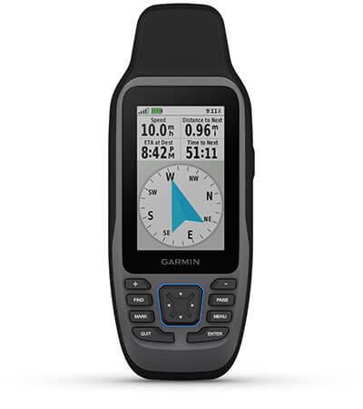
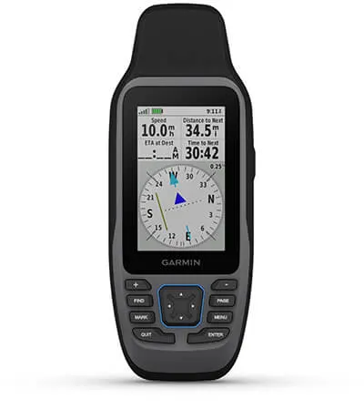
BUILT-IN COMPASS
The 3-axis tilt-compensated electronic compass shows your heading — even while the boat is standing still.

BLUECHART COVERAGE
Preloaded BlueChart g3 coastal charts (GPSMAP 79sc only) give you leading-edge coverage, clarity and detail with integrated Garmin and Navionics data. Coverage includes the U.S. and the Great Lakes.
Additional information
| Lens Material | chemically strengthened glass |
|---|---|
| Dimension | 2.67'' x 6.85'' x 1.67'' (6.77 x 17.40 x 4.23 cm) |
| Weight | 9.95 oz (282g) with batteries |
| Water rating | IPX7 |
| MIL-STD-810 | yes (thermal, shock, water); bare unit only |
| Display Type | transflective, 65K color TFT |
| Display Size | 1.5"W x 2.5"H (3.8 x 6.3 cm); 3" diag (7.6 cm) |
| Display resolution | 240 x 400 pixels |
| Battery Type | 2 AA batteries (not included); NiMH or Lithium recommended |
| Battery life | up to 19 hours |
| Memory/History | 8 GB (user space varies based on included mapping on sc version) |
| Interface | high speed microUSB and NMEA 0183 compatible |
| Preloaded maps | Available on sc version only |
| Map segments | 15,000 |
| External memory storage | yes (32 GB max microSD™ card) |
| Waypoints/favorites/locations | 10,000 |
| Courses | 250, 200 course points per course |
| Tracks | 250 |
| Navigation Track Log | 20,000 points, 250 saved gpx tracks, 300 saved fit activities |
| Navigation Routes | 250, 250 points per route; 50 points auto routing |
| Compass | Yes (tilt-compensated 3-axis) |
| Geocaching-friendly | Yes (Paperless) |
| Brand | Garmin |
General
| Lens Material | chemically strengthened glass |
|---|---|
| Dimension | 2.67'' x 6.85'' x 1.67'' (6.77 x 17.40 x 4.23 cm) |
| Weight | 9.95 oz (282g) with batteries |
| Water rating | IPX7 |
| MIL-STD-810 | yes (thermal, shock, water); bare unit only |
| Display Type | transflective, 65K color TFT |
| Display Size | 1.5"W x 2.5"H (3.8 x 6.3 cm); 3" diag (7.6 cm) |
| Display resolution | 240 x 400 pixels |
| Battery Type | 2 AA batteries (not included); NiMH or Lithium recommended |
| Battery life | up to 19 hours |
| Memory/History | 8 GB (user space varies based on included mapping on sc version) |
| Interface | high speed microUSB and NMEA 0183 compatible |
| Preloaded maps | Available on sc version only |
| Automatic routing (turn by turn routing on roads) for outdoor activities | Yes (with optional mapping for detailed roads) |
| Map segments | 15,000 |
| Includes detailed hydrographic features (coastlines, lake/river shorelines, wetlands and perennial and seasonal streams) | Yes (downloadable from Garmin Express™) |
| Includes searchable points of interests (parks, campgrounds, scenic lookouts and picnic sites) | Yes (downloadable from Garmin Express™) |
| Displays national, state and local parks, forests, and wilderness areas | Yes (downloadable from Garmin Express™) |
| External memory storage | yes (32 GB max microSD™ card) |
| Waypoints/favorites/locations | 10,000 |
| Courses | 250, 200 course points per course |
| Tracks | 250 |
| Navigation Track Log | 20,000 points, 250 saved gpx tracks, 300 saved fit activities |
| Navigation Routes | 250, 250 points per route; 50 points auto routing |
| Compass | Yes (tilt-compensated 3-axis) |
| Geocaching-friendly | Yes (Paperless) |
- GPSMAP 79s or 79sc, depending on the version selected
- Lanyard
- USB cable
- Documentation
- Engineering enhancements are ongoing and may not be reflected in the pictures, videos and specifications.
General Inquiries
There are no inquiries yet.
Related products

GPSMAP® 79 Series
$369.99Copyright 2026 © marineoverhauling

Reviews
There are no reviews yet.