
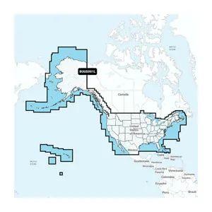

GARMIN U.S & Coastal Canada Built-In CHART UPDATE CARD

SKU: GAR010-13177-00

GARMIN U.S & Coastal Canada Built-In CHART UPDATE CARD

$199.99

Out of stock

Out of stock

We also install it: professional marine electronics installation in South Florida.

Shipping & sourcing
  • Ships from Pompano Beach, FL, United States.
  • Handling: 1 business day. Delivery: 1 to 7 business days within the United States.
  • Shipping is calculated at checkout by the carrier. Orders of $199 or more ship free.
  • Product images and specifications are supplied by the manufacturer.
Shipping & returns policy
0 People watching this product now!

Payment Methods:

Garmin Navionics+ BUS001L U.S. & Coastal Canada Built-In Chart Update Card

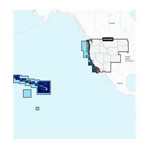
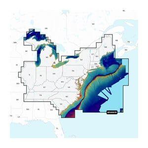
The Garmin Navionics+ BUS001L is a microSD™/SD™ chart update card delivering Garmin Navionics+ cartography across U.S. coastal waters, Alaska, Hawaii, and the West Coast of Canada, supplied on a card measuring 3.5 × 2.5 × 0.1 in (88.9 × 63.5 × 2.5 mm) and weighing 0.1 lb.
The plug-in microSD™ card upgrades Garmin chartplotters that came with built-in BlueChart® g3 coastal charts or LakeVü™ g3 inland maps to the Garmin Navionics+ all-in-one mapping solution.
Marine technicians and chartplotter owners install the card directly into a compatible Garmin unit’s card slot.

Technical Specifications

Part Number BUS001L
Card Format microSD™/SD™
Subscription Included 1 year
Weight 0.1 lb (0.045 kg)
Dimensions 3.5 × 2.5 × 0.1 in (88.9 × 63.5 × 2.5 mm)

Compatibility & Applications

  • Fits Garmin chartplotters with built-in Garmin G3 mapping preloaded; units without preloaded Garmin G3 maps are not compatible.
  • Fits GPSmap 10X2, 12X2, 12X2 Touch, 7X2, 9X2, 12X2 Plus, 8400, and 8600 series — only models with preloaded Garmin G3 Charts.
  • Replaces built-in BlueChart® g3 coastal charts and LakeVü™ g3 inland maps with the Garmin Navionics+ format.
  • Requires one update card per chartplotter serial number, even when units are networked together.
  • Pairs with the ActiveCaptain® smart-device app to deliver daily chart updates over the one-year subscription period.
  • Raster cartography cannot be viewed on echoMAP™ CHIRP and ECHOMAP™ Plus combos; viewable on mobile devices via the ActiveCaptain app.

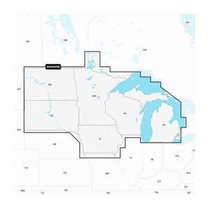
The card provides premium coastal and inland water detail for the United States including Alaska and Hawaii, as well as the West Coast of Canada.

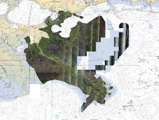
High-resolution depth range shading supports up to 10 color-shaded options, and up to 1-foot contours deliver enhanced bottom-structure detail for navigation and fishing.

Charts receive as many as 5,000 updates per day, accessible through the included one-year subscription.

Weight0.1 lbs
Dimensions3.5 × 2.5 × 0.1 in
CompatibilityGARMIN chartplotters with built-in microSD card slots
Chart CoverageU.S. and Coastal Canada
Update FrequencyAnnual updates recommended
Data FormatGarmin proprietary format
Weight0.1 lb (0.045 kg)
Dimensions3.5 x 2.5 x 0.1 in (89 x 64 x 2.5 mm)
IP RatingIP67 rated
Country of OriginUnited States
Included AccessoriesNone
Warranty1 year limited warranty
MFG#010-13177-00
UPC753759301743

Description

Garmin Navionics+ BUS001L U.S. & Coastal Canada Built-In Chart Update Card

The Garmin Navionics+ BUS001L is a microSD™/SD™ chart update card delivering Garmin Navionics+ cartography across U.S. coastal waters, Alaska, Hawaii, and the West Coast of Canada, supplied on a card measuring 3.5 × 2.5 × 0.1 in (88.9 × 63.5 × 2.5 mm) and weighing 0.1 lb.
The plug-in microSD™ card upgrades Garmin chartplotters that came with built-in BlueChart® g3 coastal charts or LakeVü™ g3 inland maps to the Garmin Navionics+ all-in-one mapping solution.
Marine technicians and chartplotter owners install the card directly into a compatible Garmin unit’s card slot.

Technical Specifications

Part Number BUS001L
Card Format microSD™/SD™
Subscription Included 1 year
Weight 0.1 lb (0.045 kg)
Dimensions 3.5 × 2.5 × 0.1 in (88.9 × 63.5 × 2.5 mm)

Compatibility & Applications

  • Fits Garmin chartplotters with built-in Garmin G3 mapping preloaded; units without preloaded Garmin G3 maps are not compatible.
  • Fits GPSmap 10X2, 12X2, 12X2 Touch, 7X2, 9X2, 12X2 Plus, 8400, and 8600 series — only models with preloaded Garmin G3 Charts.
  • Replaces built-in BlueChart® g3 coastal charts and LakeVü™ g3 inland maps with the Garmin Navionics+ format.
  • Requires one update card per chartplotter serial number, even when units are networked together.
  • Pairs with the ActiveCaptain® smart-device app to deliver daily chart updates over the one-year subscription period.
  • Raster cartography cannot be viewed on echoMAP™ CHIRP and ECHOMAP™ Plus combos; viewable on mobile devices via the ActiveCaptain app.

The card provides premium coastal and inland water detail for the United States including Alaska and Hawaii, as well as the West Coast of Canada.

High-resolution depth range shading supports up to 10 color-shaded options, and up to 1-foot contours deliver enhanced bottom-structure detail for navigation and fishing.

Charts receive as many as 5,000 updates per day, accessible through the included one-year subscription.

Specification

Overview

Weight0.1 lbs
Dimensions3.5 × 2.5 × 0.1 in
CompatibilityGARMIN chartplotters with built-in microSD card slots
Chart CoverageU.S. and Coastal Canada
Update FrequencyAnnual updates recommended
Data FormatGarmin proprietary format
Weight0.1 lb (0.045 kg)
Dimensions3.5 x 2.5 x 0.1 in (89 x 64 x 2.5 mm)
IP RatingIP67 rated
Country of OriginUnited States
Included AccessoriesNone
Warranty1 year limited warranty
MFG#010-13177-00
UPC753759301743

Customer Reviews