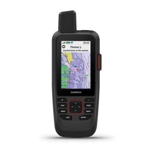
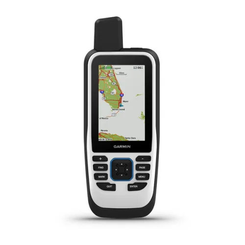
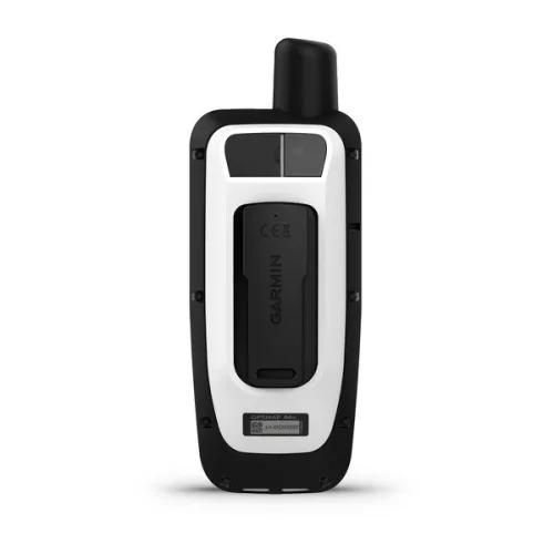
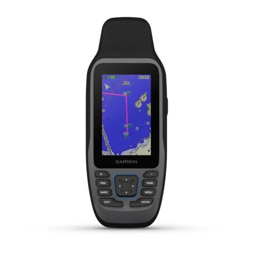
GPSMAP® 86s
$399.99
GPSMAP 86s is a handheld marine GPS with a preloaded Worldwide Basemap and the ability to stream boat data from compatible instruments.
Did you like this product? Add to favorites now and follow the product.
We are experts and sell products with a 15% discount with installation. Contact us via any method you prefer, such as WhatsApp, email, or SMS, or ask the team to sell you the equipment. Start Live Chat
- Description
- Additional information
- Reviews (0)
- Specifications
- In the Box
- More Offers
- Store Policies
- Inquiries
Description
CAST OFF CONFIDENTLY WITH A PREMIUM MARINE HANDHELD GPS
Stay on course with the GPSMAP 86s handheld. It provides all the outdoor functions of the GPSMAP® 66 series and adds on-the-water features — including wireless connectivity to your onboard marine system.
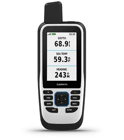
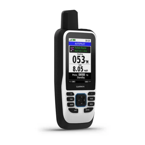
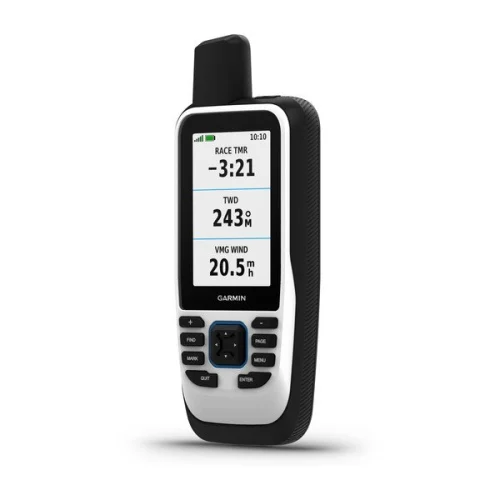
BOAT DATA
Sync with compatible Garmin chartplotters and instruments to see real-time boat data displayed right on your handheld.
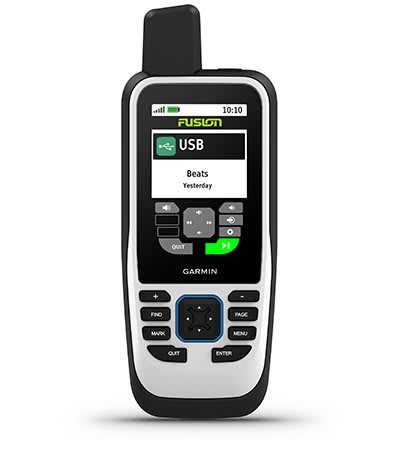
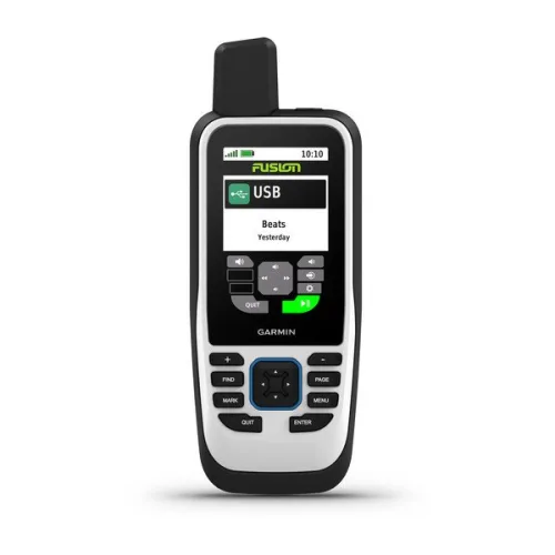
FUSION-LINK AUDIO
Get convenient remote operation of select onboard Fusion marine products.
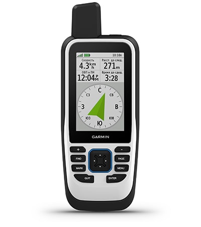
ACCURATE TRACKING
When you’re underway, an adjustable GPS filter smooths speed and heading indications as you pass over swells for more accurate tracking.
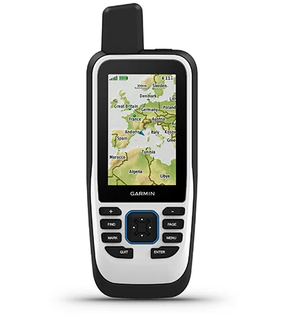
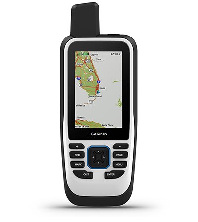
WORLDWIDE BASEMAP
See worldwide shaded relief coverage, including oceans, seas, major lakes and rivers. And see international and state political boundaries and time zone information.
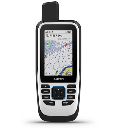
BLUECHART COVERAGE
Add optional BlueChart g3 coastal charts give you leading-edge coverage, clarity and detail with integrated Garmin and Navionics data.
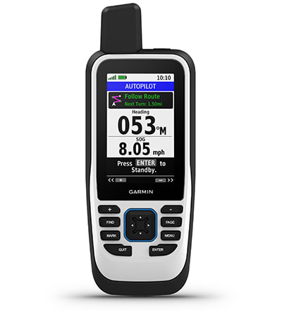
AUTOPILOT REMOTE
Even when you’re not at the helm, you can control your boat. Access the autopilot app to change heading, engage pattern steering and follow a GPS route.
BACKUP NAVIGATION
Whether you’re out for a day of fishing, sailing or cruising, gain peace of mind that comes from having a backup navigator.

ABC SENSORS
Navigate anywhere with ABC sensors, including an altimeter for elevation data, barometer to monitor weather and 3-axis electronic compass.
SMART NOTIFICATIONS
Get smart notifications right on your GPSMAP 86s handheld when you pair it with your compatible smartphone.
GARMIN EXPLORE™ APP
Sync GPSMAP 86s with Garmin Explore for cloud management of your favorite waypoints, tracks and routes.
WIRELESS CONNECTIONS
GPSMAP 86s offers Wi-Fi® connectivity, ANT+® technology and BLUETOOTH® wireless technology for easy wireless updates and connections. .
LED FLASHLIGHT
The GPSMAP 86s helps you keep gear to a minimum with a built-in LED flashlight that can be used as a beacon to signal for help.
BATTERY LIFE
The internal, rechargeable lithium battery provides up to 40 hours of battery life in standard mode and up to 200 hours in expedition mode1.
Additional information
| Lens Material | chemically strengthened glass |
|---|---|
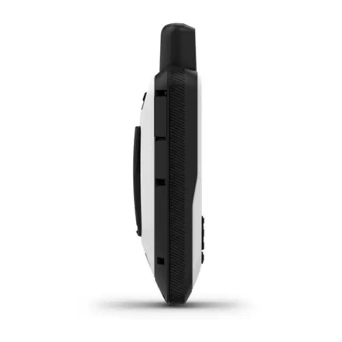
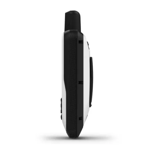
| Dimension | 2.65" x 7" x 1.7" (6.75w x 17.8h x 4.4d cm) |
| Weight | 9.59 oz (272 g) |
| Water rating | IPX7 |
| MIL-STD-810 | yes (thermal, shock, water) |
| Display Type | transflective, 65K color TFT |
| Display Size | 1.5"W x 2.5"H (3.8 x 6.3 cm); 3" diag (7.6 cm) |
| Display resolution | 240 x 400 pixels |
| Battery Type | rechargeable, internal lithium-ion |
| Battery life | up to 35 hours at 10-minute tracking; up to 200 hours at 30-minute tracking (power save mode) |
| Memory/History | 16 GB (user space varies based on included mapping) |
| Interface | high speed microUSB and NMEA 0183 compatible |
| Map segments | 15,000 |
| Satellite Imagery | yes (direct to device) |
| External memory storage | yes (32 GB max microSD™ card) |
| Waypoints/favorites/locations | 10,000 |
| Courses | 250, 200 course points per course |
| Tracks | 250 |
| Navigation Track Log | 20,000 points, 250 saved gpx tracks, 300 saved fit activities |
| Navigation Routes | 250, 250 points per route; 50 points auto routing |
| Compass | Yes (tilt-compensated 3-axis) |
| Geocaching-friendly | yes (Geocache Live) |
| Custom maps compatible | yes (500 custom map tiles) |
| Wireless Connectivity | yes (Wi-Fi®, BLUETOOTH®, ANT+®) |
| Brand | Garmin |
General
| Lens Material | chemically strengthened glass |
|---|---|
| Dimension | 2.65" x 7" x 1.7" (6.75w x 17.8h x 4.4d cm) |
| Weight | 9.59 oz (272 g) |
| Water rating | IPX7 |
| MIL-STD-810 | yes (thermal, shock, water) |
| Display Type | transflective, 65K color TFT |
| Display Size | 1.5"W x 2.5"H (3.8 x 6.3 cm); 3" diag (7.6 cm) |
| Display resolution | 240 x 400 pixels |
| Battery Type | rechargeable, internal lithium-ion |
| Battery life | up to 35 hours at 10-minute tracking; up to 200 hours at 30-minute tracking (power save mode) |
| Memory/History | 16 GB (user space varies based on included mapping) |
| Interface | high speed microUSB and NMEA 0183 compatible |
| Map segments | 15,000 |
| Satellite Imagery | yes (direct to device) |
| Includes searchable points of interests (parks, campgrounds, scenic lookouts and picnic sites) | Yes (downloadable from Garmin Express™) |
| Displays national, state and local parks, forests, and wilderness areas | Yes (downloadable from Garmin Express™) |
| External memory storage | yes (32 GB max microSD™ card) |
| Waypoints/favorites/locations | 10,000 |
| Courses | 250, 200 course points per course |
| Tracks | 250 |
| Navigation Track Log | 20,000 points, 250 saved gpx tracks, 300 saved fit activities |
| Navigation Routes | 250, 250 points per route; 50 points auto routing |
| Compass | Yes (tilt-compensated 3-axis) |
| Geocaching-friendly | yes (Geocache Live) |
| Custom maps compatible | yes (500 custom map tiles) |
| Wireless Connectivity | yes (Wi-Fi®, BLUETOOTH®, ANT+®) |
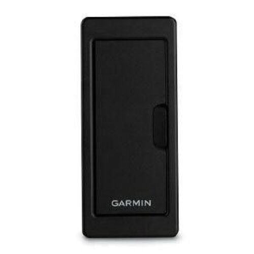
- GPSMAP 86s handheld with worldwide basemap
- Lanyard
- USB to Micro USB cable
- Documentation
General Inquiries
There are no inquiries yet.
Related products
Recently Viewed Products

GPSMAP® 86s
$399.99Copyright 2026 © marineoverhauling

Reviews
There are no reviews yet.