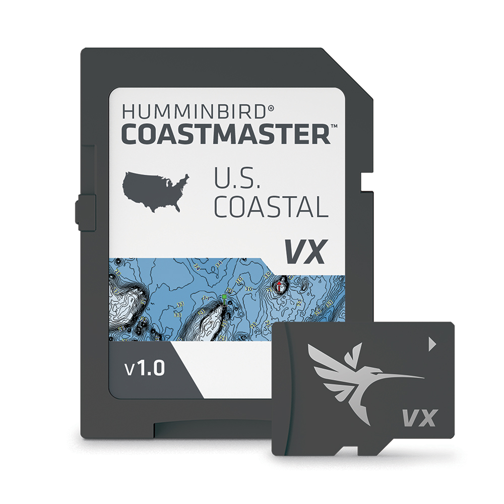

Humminbird Coastmaster™ Chart

Humminbird marine products include transducers, navigation parts and accessories, marine charts and maps, chartplotters, fishing and sonar equipment, and communication/network products. Product lines include APEX, XPLORE, HELIX, MEGA Live, and MEGA 360 Imaging.

Part Number: 601015-1 · Category: Marine Charts & Maps

Humminbird

$179.99

In stock · ships from Pompano Beach, FL

18 in stock

Request a QuoteSeveral units or a fleet job? Ask for volume pricing.
Item
Shipping
Total
Oversize item: call (786) 277-2596 for a freight quote.
Ships from Pompano Beach, FL. Rate shown is for Florida (1-2 business days); other states 1 to 7 business days, exact rate by ZIP at checkout.
★★★★★ 5.0 rated on Google (21 reviews) · ✓ 30-day returns · ✓ Secure payment by Stripe

We sell it. We install it.

Professional marine electronics installation available in South Florida. Free quotes, and boat pickup and transport for qualifying boats and projects.

Get an Installation Quote Call +1 (786) 277-2596

Shipping & sourcing
  • Ships from Pompano Beach, FL, United States.
  • Handling: 1 business day. Delivery: 1 to 7 business days within the United States.
  • Shipping is calculated at checkout by the carrier. Orders of $199 or more ship free.
  • Product images and specifications are supplied by the manufacturer.
Shipping & returns policy
0 People watching this product now!

Payment Methods:

Product details

BrandHumminbird
Part Number601015-1
CategoryMarine Charts & Maps
AvailabilityIn stock
Ships fromPompano Beach, FL · 1 business day handling
InstallationAvailable in Pompano Beach and Broward County
Weight0.17 lbs

Coastmaster™ Chart

Plan Your Attack

Find the path to your next big catch with the incredible accuracy and detail of Humminbird® CoastMaster™. With easy-to-read contours and chart customization, you’ll have the tools you need to identify the spots you know will hold fish and navigate there safely. Building on the latest data available, CoastMaster™ delivers unrivaled nearshore and offshore fishing performance.

Complete Coastal Coverage

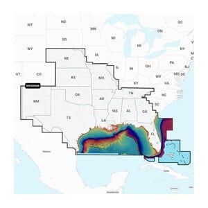
We’ve got you covered from sea to shining sea. Always know where you are and what’s ahead with full chart detail for the East Coast, West Coast, and the Gulf of Mexico, complete with 3, 9, 12, 24, and 200-mile markers.

VX Technology

Don’t delay. VX technology provides five customizable color palettes and fast map load times, so you can seize every moment on the water.

Chart Views

See the world your way with three chart view presets. Individually customize Fishing, Navigation and User presets to quickly cycle between your favorite settings for specific fishing scenarios. Spend less time with settings, and more time setting the hook.

Tides and Currents

Whichever way the tide rolls, make sure it’s in your favor. CoastMaster’s predictive software allows you to plan your fishing day with tidal direction and height, as well as the speed and direction of currents and more, so you’ll never be caught guessing.

Better Together

Unlock more from your CoastMaster™ chart with the power of One-Boat Network™. Pair your Humminbird chartplotter and a Minn Kota® trolling motor with i-Pilot® Link™ to control your trolling motor right from your unit. For hands-free fishing, your trolling motor can automatically follow a depth contour on your CoastMaster™ chart.

Features:

  • VX Technology provides five customizable color palettes and faster map load times, so you can seize every moment on the water.
  • See the world your way with three preset views. It’s quick and easy to switch from fishing charts to nautical charts, or to create your own custom view settings.
  • Using predictive software, CoastMaster™ allows you to plan your fishing day with tidal direction and height, as well as the speed and direction of currents and more, so you’ll never be caught guessing.
  • Create up to four user-defined depth highlight ranges, so you can easily target productive water and stay in the bite zone.
  • Navigate safely and quickly identify spots where fish are hiding with red shading highlights for shallow water areas on an adjustable range from zero to 30 feet.
  • Synchronize the depth contours and shorelines of your CoastMaster™ charts with the actual water levels, so that your chart will reflect the current water level of your fishing spots.
  • Access a wealth of navigational data to make your next trip safe and successful. Access navigation aids, artificial reefs and points of interest.
  • When paired with a Minn Kota i-Pilot Link, you can “follow” a selected depth contour line, delivering precise, automatic boat control
  • Compatible with Humminbird HELIX® G3/G3N and all SOLIX® units.
  • 1-Year Cartography Warranty. Opened packages are not eligible for return.

Weight0.17 lbs
Dimensions7.25 × 5.25 × 0.63 in
MFG#601015-1
UPC082324054112
0 reviews
0
0
0
0
0

There are no reviews yet.

Be the first to review “Humminbird Coastmaster™ Chart”

Your email address will not be published. Required fields are marked *

1 2 3 4 5
1 2 3 4 5
1 2 3 4 5

Humminbird marine products include transducers, navigation parts and accessories, marine charts and maps, chartplotters, fishing and sonar equipment, and communication/network products. Product lines include APEX, XPLORE, HELIX, MEGA Live, and MEGA 360 Imaging.

Description

Coastmaster™ Chart

Plan Your Attack

Find the path to your next big catch with the incredible accuracy and detail of Humminbird® CoastMaster™. With easy-to-read contours and chart customization, you’ll have the tools you need to identify the spots you know will hold fish and navigate there safely. Building on the latest data available, CoastMaster™ delivers unrivaled nearshore and offshore fishing performance.

Complete Coastal Coverage

We’ve got you covered from sea to shining sea. Always know where you are and what’s ahead with full chart detail for the East Coast, West Coast, and the Gulf of Mexico, complete with 3, 9, 12, 24, and 200-mile markers.

VX Technology

Don’t delay. VX technology provides five customizable color palettes and fast map load times, so you can seize every moment on the water.

Chart Views

See the world your way with three chart view presets. Individually customize Fishing, Navigation and User presets to quickly cycle between your favorite settings for specific fishing scenarios. Spend less time with settings, and more time setting the hook.

Tides and Currents

Whichever way the tide rolls, make sure it’s in your favor. CoastMaster’s predictive software allows you to plan your fishing day with tidal direction and height, as well as the speed and direction of currents and more, so you’ll never be caught guessing.

Better Together

Unlock more from your CoastMaster™ chart with the power of One-Boat Network™. Pair your Humminbird chartplotter and a Minn Kota® trolling motor with i-Pilot® Link™ to control your trolling motor right from your unit. For hands-free fishing, your trolling motor can automatically follow a depth contour on your CoastMaster™ chart.

Features:

  • VX Technology provides five customizable color palettes and faster map load times, so you can seize every moment on the water.
  • See the world your way with three preset views. It’s quick and easy to switch from fishing charts to nautical charts, or to create your own custom view settings.
  • Using predictive software, CoastMaster™ allows you to plan your fishing day with tidal direction and height, as well as the speed and direction of currents and more, so you’ll never be caught guessing.
  • Create up to four user-defined depth highlight ranges, so you can easily target productive water and stay in the bite zone.
  • Navigate safely and quickly identify spots where fish are hiding with red shading highlights for shallow water areas on an adjustable range from zero to 30 feet.
  • Synchronize the depth contours and shorelines of your CoastMaster™ charts with the actual water levels, so that your chart will reflect the current water level of your fishing spots.
  • Access a wealth of navigational data to make your next trip safe and successful. Access navigation aids, artificial reefs and points of interest.
  • When paired with a Minn Kota i-Pilot Link, you can “follow” a selected depth contour line, delivering precise, automatic boat control
  • Compatible with Humminbird HELIX® G3/G3N and all SOLIX® units.
  • 1-Year Cartography Warranty. Opened packages are not eligible for return.
Specification

Overview

Weight0.17 lbs
Dimensions7.25 × 5.25 × 0.63 in
MFG#601015-1
UPC082324054112

Customer Reviews

0 reviews
0
0
0
0
0

There are no reviews yet.

Be the first to review “Humminbird Coastmaster™ Chart”

Your email address will not be published. Required fields are marked *

1 2 3 4 5
1 2 3 4 5
1 2 3 4 5