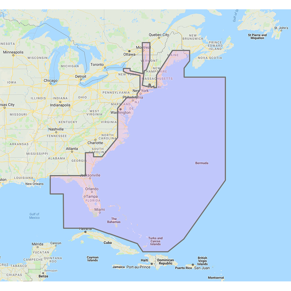

Furuno U.S. East Coast, Bahamas & Bermuda – Vector Charts & Standard Resolution Satellite Photos f/Bahamas – Unlock Code

Furuno marine products include transducers, radars, navigation parts and accessories, network parts, chartplotters, and autopilot equipment. Product lines include NavNet TZtouchXL, DRS, TZT3, NavPilot, and FCV sounder families.

Part Number: MM3-VNA-022 · Category: Marine Charts & Maps

Furuno

$263.00

Out of stock

★★★★★ 5.0 rated on Google (21 reviews) · ✓ 30-day returns · ✓ Secure payment by Stripe

We also install it: professional marine electronics installation in South Florida.

Shipping & sourcing
  • Ships from Pompano Beach, FL, United States.
  • Handling: 1 business day. Delivery: 1 to 7 business days within the United States.
  • Shipping is calculated at checkout by the carrier. Orders of $199 or more ship free.
  • Product images and specifications are supplied by the manufacturer.
Shipping & returns policy
0 People watching this product now!

Payment Methods:

Product details

BrandFuruno
Part NumberMM3-VNA-022
CategoryMarine Charts & Maps
AvailabilitySpecial order
Ships fromPompano Beach, FL · lead time confirmed when you order
InstallationAvailable in Pompano Beach and Broward County

U.S. East Coast, Bahamas & Bermuda – Vector Charts & Standard Resolution Satellite Photos for Bahamas – Unlock Code

**SYSTEM ID NUMBER IS REQUIRED TO RECEIVE AN UNLOCK CODE**

This Chart Pack includes vector charts for United States East Coast, Bahamas and Bermuda, plus standard resolution satellite photography for the Bahamas.

These C-MAP charts are comprised of the same cartographic chart information found in C-MAP MAX and C-MAP MAX PRO charts.

Note that you will need to purchase an unlock code to view this chart data. 

To purchase this chart pack for NavNet 3D, TZT or TZT2, you will need to provide your NavNet system ID to your local authorized Furuno dealer. The system ID can be located under the “My NavNet” menu.

WarningWARNING: This product can expose you to chemicals which are known to the State of California to cause cancer, birth defects or other reproductive harm. For more information go to P65Warnings.ca.gov.

MFG#MM3-VNA-022
0 reviews
0
0
0
0
0

There are no reviews yet.

Be the first to review “Furuno U.S. East Coast, Bahamas & Bermuda – Vector Charts & Standard Resolution Satellite Photos f/Bahamas – Unlock Code”

Your email address will not be published. Required fields are marked *

1 2 3 4 5
1 2 3 4 5
1 2 3 4 5

Furuno marine products include transducers, radars, navigation parts and accessories, network parts, chartplotters, and autopilot equipment. Product lines include NavNet TZtouchXL, DRS, TZT3, NavPilot, and FCV sounder families.

Description

U.S. East Coast, Bahamas & Bermuda – Vector Charts & Standard Resolution Satellite Photos for Bahamas – Unlock Code

**SYSTEM ID NUMBER IS REQUIRED TO RECEIVE AN UNLOCK CODE**

This Chart Pack includes vector charts for United States East Coast, Bahamas and Bermuda, plus standard resolution satellite photography for the Bahamas.

These C-MAP charts are comprised of the same cartographic chart information found in C-MAP MAX and C-MAP MAX PRO charts.

Note that you will need to purchase an unlock code to view this chart data. 

To purchase this chart pack for NavNet 3D, TZT or TZT2, you will need to provide your NavNet system ID to your local authorized Furuno dealer. The system ID can be located under the “My NavNet” menu.

WarningWARNING: This product can expose you to chemicals which are known to the State of California to cause cancer, birth defects or other reproductive harm. For more information go to P65Warnings.ca.gov.
Specification

Overview

MFG#MM3-VNA-022

Customer Reviews

0 reviews
0
0
0
0
0

There are no reviews yet.

Be the first to review “Furuno U.S. East Coast, Bahamas & Bermuda – Vector Charts & Standard Resolution Satellite Photos f/Bahamas – Unlock Code”

Your email address will not be published. Required fields are marked *

1 2 3 4 5
1 2 3 4 5
1 2 3 4 5