
Garmin BlueChart® g3 HD – HXUS030R – Southeast Caribbean – microSD™/SD™

Garmin marine products include transducers, navigation parts and accessories, chartplotters, marine charts and maps, trolling motors, and communication/network equipment. Garmin product lines include GPSMAP, GMR Fantom, GMR xHD3, and Navionics+.

Part Number: 010-C0731-20 · Category: Marine Charts & Maps

Garmin

$149.99

In stock · ships from Pompano Beach, FL

1 in stock

Request a QuoteSeveral units or a fleet job? Ask for volume pricing.
Item
Shipping
Total
Oversize item: call (786) 277-2596 for a freight quote.
Ships from Pompano Beach, FL. Rate shown is for Florida (1-2 business days); other states 1 to 7 business days, exact rate by ZIP at checkout.
★★★★★ 5.0 rated on Google (21 reviews) · ✓ 30-day returns · ✓ Secure payment by Stripe

We sell it. We install it.

Professional marine electronics installation available in South Florida. Free quotes, and boat pickup and transport for qualifying boats and projects.

Get an Installation Quote Call +1 (786) 277-2596

Shipping & sourcing
  • Ships from Pompano Beach, FL, United States.
  • Handling: 1 business day. Delivery: 1 to 7 business days within the United States.
  • Shipping is calculated at checkout by the carrier. Orders of $199 or more ship free.
  • Product images and specifications are supplied by the manufacturer.
Shipping & returns policy
0 People watching this product now!

Payment Methods:

Product details

BrandGarmin
Part Number010-C0731-20
CategoryMarine Charts & Maps
AvailabilityIn stock
Ships fromPompano Beach, FL · 1 business day handling
InstallationAvailable in Pompano Beach and Broward County
Weight0.08 lbs

BlueChart® g3 HD – HXUS030R – Southeast Caribbean – microSD™/SD™

Coverage:

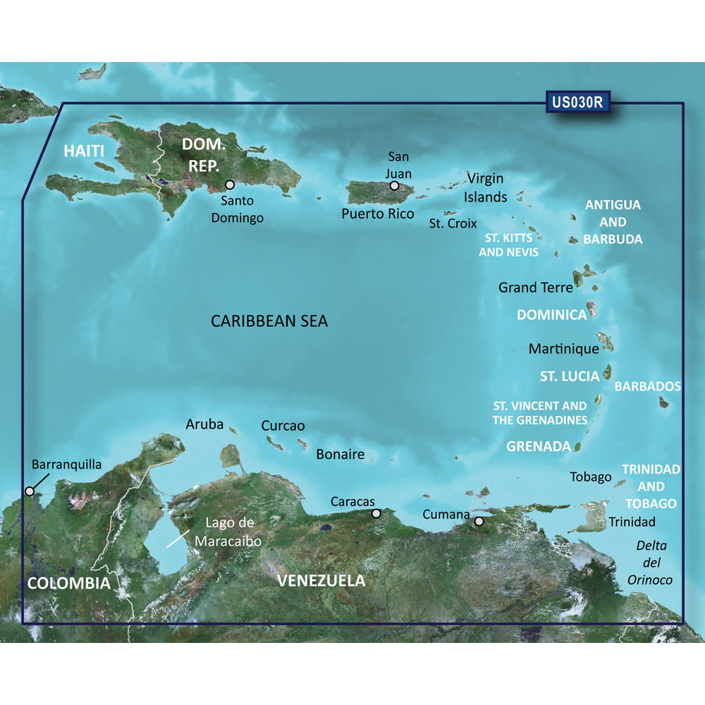
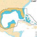
Covers the Caribbean from Haiti to Trinidad & Tobago, including Puerto Rico and all of the Lesser Antilles. Also includes the Colombian and Venezuelan coasts from Barranquilla, Colombia to the mouth of the Orinoco River, including Lake Maracaibo and the Gulf of Paria.

Our Advanced Chart Offering

  • Derived from official charts and private sources to provide navigational aids, spot soundings, depth contours, tides and currents, and detailed harbors and marinas
  • Depth Range Shading for up to 10 depth ranges enables you to view your target depth at a glance
  • Up to 1-foot contours provide a more accurate depiction of the bottom structure for improved fishing charts and navigation in swamps, canals and marinas
  • Shallow Water Shading feature allows for depth shading at a user-defined level to aid in navigation

Advanced Chart Detail

Detailed charts help the mariner guide their boat in and out of port with confidence.

Depth Range Shading

Displays high-resolution Depth Range Shading for up to 10 depth ranges so you can view your designated target depth.

Detailed Contours

BlueChart g3 HD features 1-foot contours that provide a more accurate depiction of bottom structure for improved fishing charts and enhanced detail in swamps, canals and port plans.

WarningWARNING: This product can expose you to chemicals which are known to the State of California to cause cancer, birth defects or other reproductive harm. For more information go to P65Warnings.ca.gov.

This product may not be returned to the original point of purchase. Please contact the manufacturer directly with any issues or concerns.

Weight0.08 lbs
Dimensions5.13 × 4.88 × 0.25 in
MFG#010-C0731-20
UPC753759089344
0 reviews
0
0
0
0
0

There are no reviews yet.

Be the first to review “Garmin BlueChart® g3 HD – HXUS030R – Southeast Caribbean – microSD™/SD™”

Your email address will not be published. Required fields are marked *

1 2 3 4 5
1 2 3 4 5
1 2 3 4 5

Garmin marine products include transducers, navigation parts and accessories, chartplotters, marine charts and maps, trolling motors, and communication/network equipment. Garmin product lines include GPSMAP, GMR Fantom, GMR xHD3, and Navionics+.

Description

BlueChart® g3 HD – HXUS030R – Southeast Caribbean – microSD™/SD™

Coverage:

Covers the Caribbean from Haiti to Trinidad & Tobago, including Puerto Rico and all of the Lesser Antilles. Also includes the Colombian and Venezuelan coasts from Barranquilla, Colombia to the mouth of the Orinoco River, including Lake Maracaibo and the Gulf of Paria.

Our Advanced Chart Offering

  • Derived from official charts and private sources to provide navigational aids, spot soundings, depth contours, tides and currents, and detailed harbors and marinas
  • Depth Range Shading for up to 10 depth ranges enables you to view your target depth at a glance
  • Up to 1-foot contours provide a more accurate depiction of the bottom structure for improved fishing charts and navigation in swamps, canals and marinas
  • Shallow Water Shading feature allows for depth shading at a user-defined level to aid in navigation

Advanced Chart Detail

Detailed charts help the mariner guide their boat in and out of port with confidence.

Depth Range Shading

Displays high-resolution Depth Range Shading for up to 10 depth ranges so you can view your designated target depth.

Detailed Contours

BlueChart g3 HD features 1-foot contours that provide a more accurate depiction of bottom structure for improved fishing charts and enhanced detail in swamps, canals and port plans.

WarningWARNING: This product can expose you to chemicals which are known to the State of California to cause cancer, birth defects or other reproductive harm. For more information go to P65Warnings.ca.gov.

This product may not be returned to the original point of purchase. Please contact the manufacturer directly with any issues or concerns.
Specification

Overview

Weight0.08 lbs
Dimensions5.13 × 4.88 × 0.25 in
MFG#010-C0731-20
UPC753759089344

Customer Reviews

0 reviews
0
0
0
0
0

There are no reviews yet.

Be the first to review “Garmin BlueChart® g3 HD – HXUS030R – Southeast Caribbean – microSD™/SD™”

Your email address will not be published. Required fields are marked *

1 2 3 4 5
1 2 3 4 5
1 2 3 4 5